功能說明
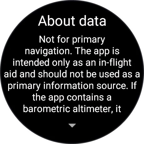
WARNING: The app is intended only as an in-flight aid and should not be used as a primary information source. If the app contains a barometric altimeter, it will not function in a pressurized aircraft and should not be used in a pressurized aircraft.
VarioTracker v2 is a secondary flight instrument for free flight without an aviation radio: vario, altimeter, flight recorder and airspace information with alerts.
A recreational aid: not a means of airspace clearance, not a collision-avoidance or safety system, not for primary navigation. Airspace data can be incomplete, outdated or wrong; NOTAM and AIP SUP areas may be missing, activation times are not known. An official pre-flight briefing is mandatory. The pilot is responsible for every flight.
FEATURES
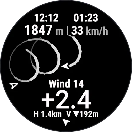
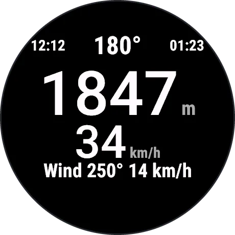
- Vario, barometric altitude, ground speed, heading, wind, thermal view with climb trail; automatic FIT recording from takeoff with vario and QNH fields. To end: Menu, End flight.
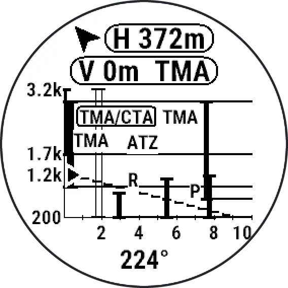
- Airspace: horizontal and vertical distance to the nearest zone, floors and ceilings; side view with walls and glide line. Vibration and tone when a forbidden zone is within your set distances (default 500 m / 300 m) and at each step closer, opening the side view; inside a zone, the distance to its nearest boundary is shown.
- Forbidden without radio or transponder (the app's classification, not a legal ruling): controlled airspace (A-D; E in IT, SI), restricted and prohibited areas, RMZ, ATZ, FIZ, TMZ (not CH), TRA, danger areas in AT, SI, IT, unknown types. Caution (short vibration): danger areas in DE, CH, FR, parachute zones, most parks, CH/IT aerodrome zones.
REQUIREMENTS
- Built-in data (offline): only the core Alps (6-15°E, 45.5-48.3°N) and only forbidden zones; updated only with app releases.
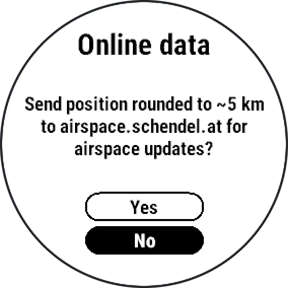
- Elsewhere, and for caution zones, Online data is needed: a paired phone with Garmin Connect running (background is fine) and internet. Data for about 50 km around you comes from airspace.schendel.at, the developer's private server (no guaranteed availability).
- Online data is off until you agree at first start. While on, your position rounded to about 5 km is sent at app start or switch-on, after about 40 km, when stopped 10 km from the last download, on retries while data is incomplete (every 10-30 s in flight), daily and on Update now. Positions are not logged. Switch it off any time (watch: Menu, Data; or app settings on the phone). Sent data goes to the developer, not to Garmin; Garmin is not responsible for it. Privacy: https://airspace.schendel.at/privacy
- Coverage: full rules DE, AT, CH/LI, FR, IT; basic rules SI, AD, BA, BE, CZ, DK, ES, GB, HR, HU, LU, MC, NL, PL, RS, SK, SM, VA. No airspace data elsewhere.
LIMITATIONS
- Downloaded data is complete to about 40 km from the download point; some 8 km beyond, alerts can miss zones (signalled; core Alps: built-in data takes over).
- Activation-dependent zones always count as active (*); most openings (e.g. AT TRA) are not modelled. Unverified items (IT danger areas, FR/IT national parks, AT/SI MTAs) can give false alerts; DE nature reserves and CH wildlife zones are missing.
- Alerts work only while the app is open; notifications or calls on top limit them ("Alarm gap"). They follow the watch's vibration and tone settings.
- Metric units only. Watch texts in English. No audio vario.
Data: openAIP (www.openaip.net, CC BY-NC 4.0, modified; derived airspace data CC BY-NC 4.0), open flightmaps (OFMA General Users' License; errors: openflightmaps.org), terrain Copernicus EU-DEM, NOAA ETOPO1, USGS SRTM/GMTED2010. Full credits in About data.
Devices: fēnix 8 (43/47/51 mm, Pro, Pro MicroLED, Solar 47/51 mm), tactix 8 (47/51 mm, Solar 51 mm), quatix 8 (47/51 mm, Pro); fēnix 9 (43/47/51 mm), 9 Pro (43/47/51 mm), 9 Pro Solar (47/51 mm). AMOLED and MIP.
Free, no ads.
更新記錄
Thermal view reworked:
- More room for the climb trail: altitude and speed moved to the top edge, clock and flight time removed from this view.
- The trail shows climb only (no sink), stays visible for 90 seconds and drifts with the wind, so the thermal core stays in place on screen.
- Wind speed and climb rate side by side at the bottom; a solid chevron at the display edge shows the wind direction (black on MIP, white on AMOLED).
- Inside a forbidden zone a single line shows the way out.
Airspace alarms:
- Every alarm step for a forbidden zone now also shows a short message with its name and distance (for example "TMA 450m"), unless the side view is already open.
- Messages that are not the result of a button press are now announced by a vibration; warnings such as "Out of data" also by a tone.
Airspace data:
- Built-in airspace updated (2026-10-07).
- Temporary zones in the built-in data now end on the watch 24 hours after their published end, so they no longer raise alarms after they expire.
螢幕截圖
支援語言(1)
相容機型(14)
fēnix® 8 AMOLED (43mm)
fēnix® 8 AMOLED (47mm/51mm)
fēnix® 8 Pro
fēnix® 8 Solar (47mm)
fēnix® 8 Solar (51mm)
fenix® 9 - 43 mm
fenix® 9 – 47 mm
fenix® 9 Pro - 43 mm
fenix® 9 Pro - 47 mm
fenix® 9 Pro - 51 mm
fenix® 9 Pro - Solar 47 mm
fenix® 9 Pro - Solar 51 mm
tactix® 8 – 47 mm, AMOLED
tactix® 8 – 51 mm, Solar
最近指標趨勢
評分
評論
快照日期
2026-10-27 → 2026-11-03