Opis
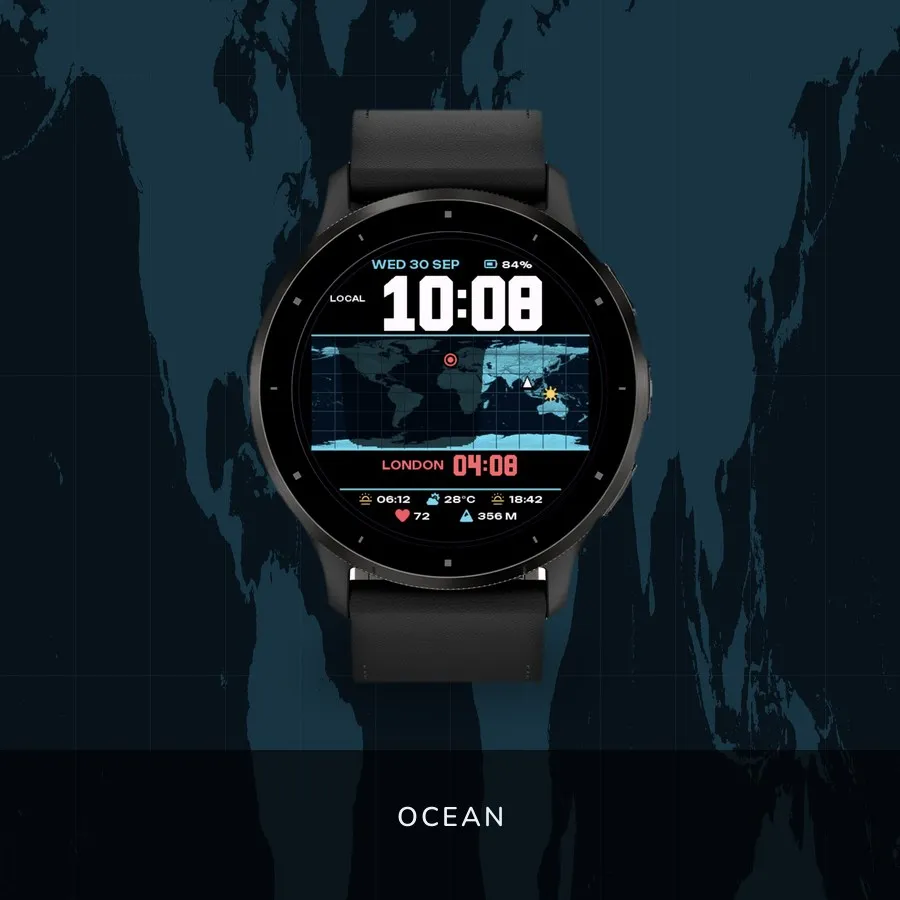
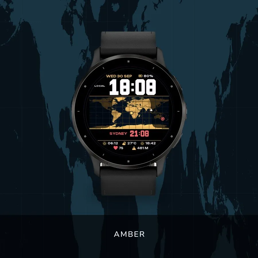
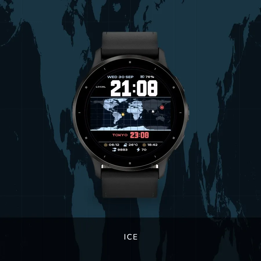
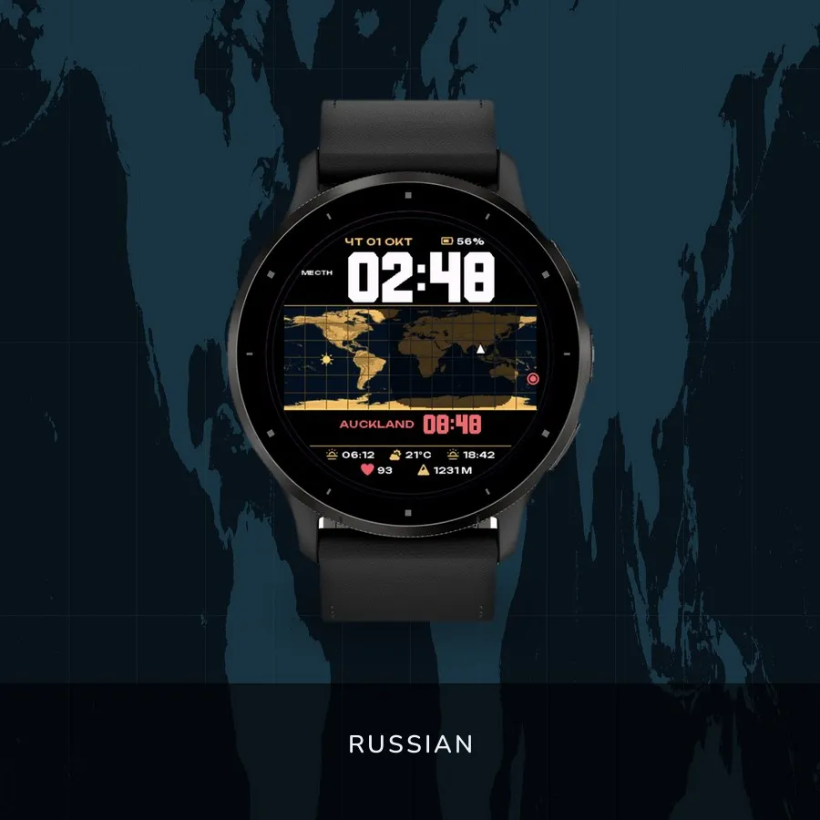
A world map on your wrist, with the day and night boundary moving across it.
————————————————————————
OCEAN · AMBER · ICE
————————————————————————
The yellow dot is the point where the Sun is directly overhead right now. The
shadow around it is real geometric night, recomputed every minute from UTC. A
white triangle marks your last known position; a red ring marks your chosen city.
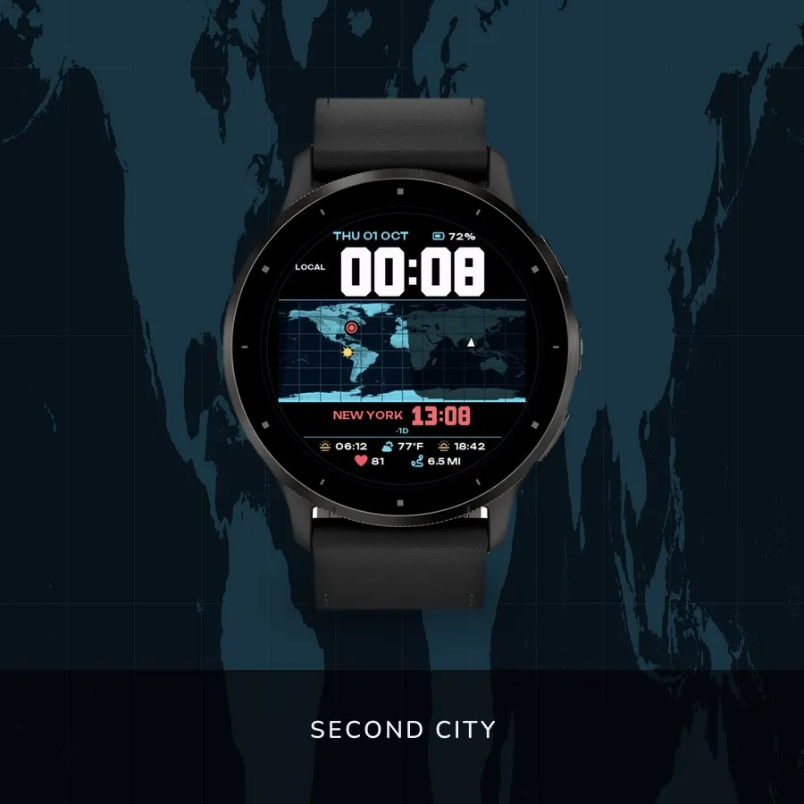
A SECOND CITY
Pick one of 32 and its time sits under yours. Garmin resolves its time zone and
daylight-saving rules from the coordinates. If the date there is different, a
+1D or −1D appears beside it.
ALSO ON SCREEN
— Large local time, the date and the battery
— Sunrise and sunset for your location, and the temperature from Garmin weather
— Two fields below, chosen by you: heart rate, altitude, steps, Body Battery,
stress, calories, distance, wind, floors, active minutes, notifications,
battery, temperature, solar times — or nothing
— 12 or 24 hours, English by default, Russian in settings
— Always-on leaves the outlined time on black; the map is not drawn
HONEST ABOUT ACCURACY
The face never starts the GPS and never substitutes a weather station for your
position. With no known fix it shows NO GPS under the local time and drops the
triangle and the solar times. A stored fix goes stale after a flight — refresh it
by starting an outdoor activity.
The boundary is geometric: twilight and refraction are not modelled. The map
shows land, not countries.
More watch faces: https://watchfacekit.com/
Questions and answers: https://watchfacekit.com/faq/
How to install: https://watchfacekit.com/how-to-install-garmin-watch-faces/
Snimke zaslona
Podržanih jezika (5)
Kompatibilna uređaja (64)
Approach® S50
Approach® S70 (42mm)
Approach® S70 (47mm)
Approach® S72 - 43 mm
Approach® S72 - 47 mm
D2™ Air X10
D2™ Air X15
D2™ Mach 1
D2™ Mach 1 Pro
D2™ Mach 2
D2™ Mach 2 Pro
Descent™ G2
Descent™ MK3 - 43mm
Descent™ MK3i - 51mm
epix™ (Gen 2)
epix™ (Gen 2)
epix™ Pro (42mm)
epix™ Pro (47mm)
epix™ Pro (51mm)
fēnix® 8 AMOLED (43mm)
fēnix® 8 AMOLED (47mm/51mm)
fēnix® 8 Pro
fenix® 9 - 43 mm
fenix® 9 – 47 mm
fenix® 9 Pro - 43 mm
fenix® 9 Pro - 47 mm
fenix® 9 Pro - 51 mm
fēnix® E
Forerunner® 165
Forerunner® 165 Music
Forerunner® 170
Forerunner® 170 Music
Forerunner® 265
Forerunner® 265S
Forerunner® 570 - 42mm
Forerunner® 570 - 47mm
Forerunner® 70
Forerunner® 70
Forerunner® 965
Forerunner® 970
Instinct® 3 – 45 mm, AMOLED
Instinct® 3 – 50 mm, AMOLED
MARQ® (Gen 2)
MARQ® Adventurer (Gen 3)
MARQ® Commander (Gen 2) – Carbon Edition
MARQ™ Aviator (Gen 2)
Mercedes-Benz Venu® 2
Mercedes-Benz Venu® 2
Mercedes-Benz Venu® 2S
Mercedes-Benz Venu® 2S
tactix® 7 – AMOLED Edition
tactix® 8 – 47 mm, AMOLED
Venu® 2
Venu® 2
Venu® 2 Plus
Venu® 2 Plus
Venu® 2S
Venu® 2S
Venu® 3
Venu® 3S
Venu® 4 – 41 mm
Venu® 4 – 45 mm
vívoactive® 5
vívoactive® 6