Description
A lightweight, offline application leveraging GPS to provide essential navigation capabilities for tactical operations. The app operates without internet or external communication, ensuring reliability in isolated environments. It uses a grid-based interface and supports map mode on supported devices, adhering to minimalistic and secure design principles. The application supports UCS2000, WGS84, and MGRS coordinate systems for versatile mission planning and situational awareness. With minimal MIL-STD-2525D symbology, users can zoom from 1m to 1000km and utilize a built-in dark mode for optimal low-light usability. Designed for simplicity, efficiency, and reliability, Tactical Navigation delivers robust functionality in the field.
-----------------
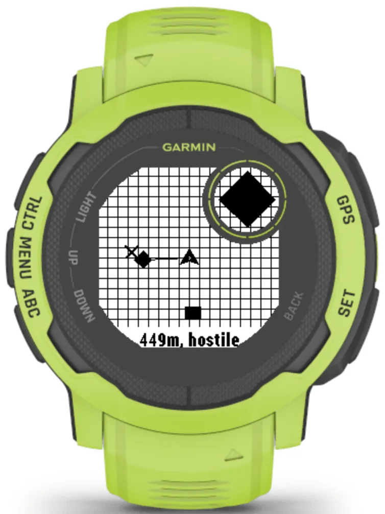
Note: Maps in Instinct watches.
After several implementation attempts, it appears this is not possible with the current SDK and hardware limitations.
-----------------
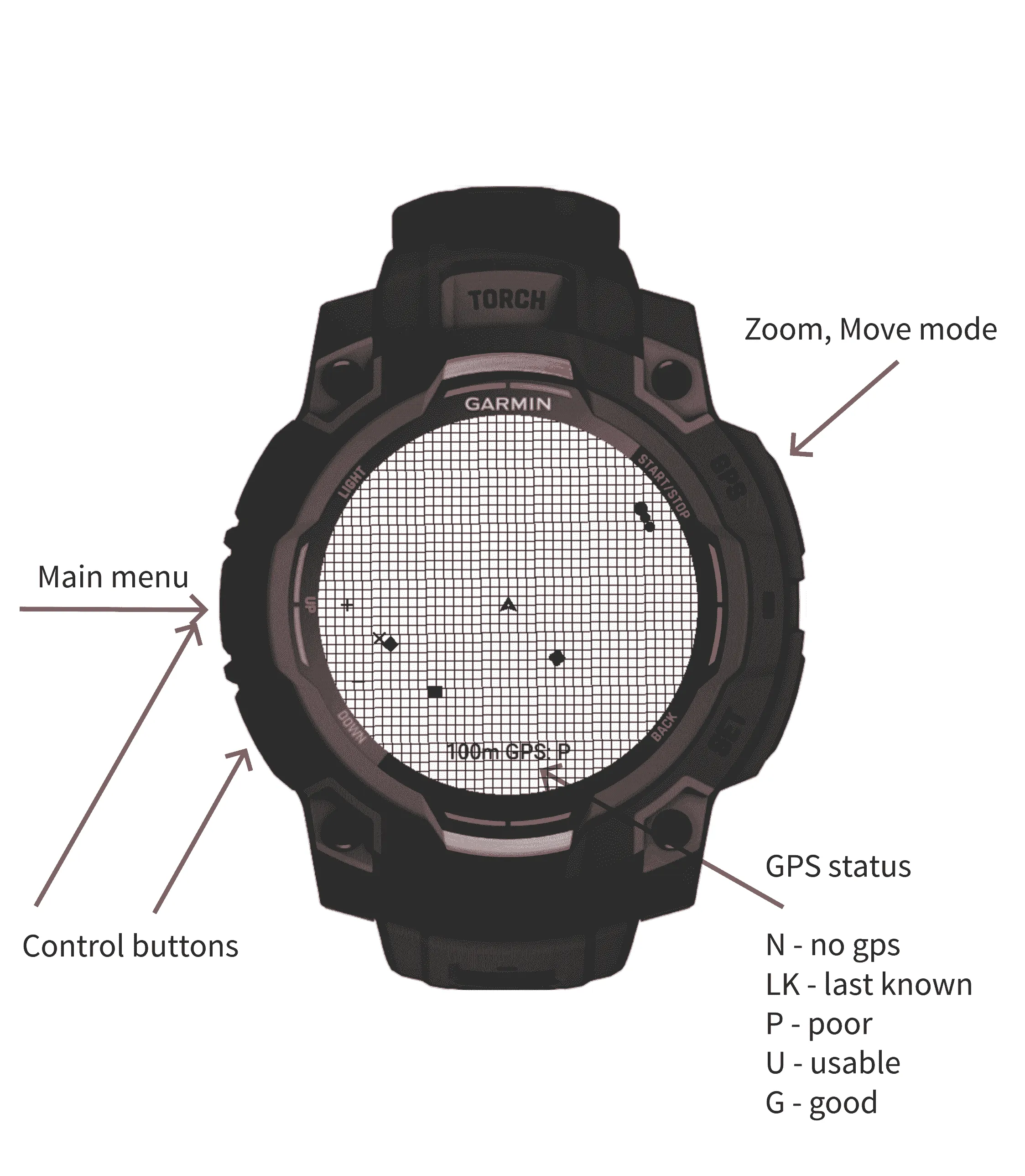
GPS status / Статус GPS:
-----------------
N / Н - no gps / немає GPS
LK / ОВ - last known / останнє відоме
P / П - poor / погано
U / ПР - usable / придатне
G / Д - good / добре
-----------------
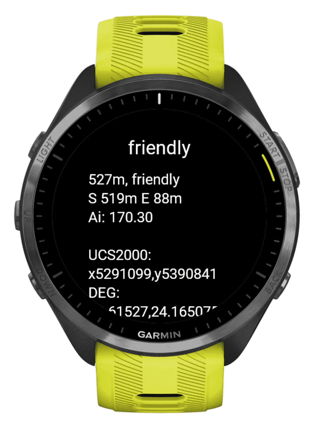
Points data is stored in text format in the data field that can be edited/added using the Connect IQ application settings.
-----------------
Format: longitude, latitude: name: code
Special case: longitude, latitude: my
Records:
Multiple records are separated by a semicolon (;). Each record represents a distinct point.
Codes:
1003000000 = friendly
1004000000 = neutral
1006000000 = hostile
1001000000 = unknown
1318000000 = waypoint
Example:
48.615268, 24.165075: friendly: 1003000000; 48.619548, 24.137723: neutral: 1004000000; 48.619866, 24.158428: hostile: 1006000000; 48.618270, 24.183381: unknown: 1001000000; 48.620507, 24.156844: waypoint: 1318000000; 48.628074, 24.177027: my
Note:
The 'my' record indicates your personal point on the map.
-----------------
Enjoying my work? Help fuel my passion—feel free to donate: https://beacons.ai/volodymyrkopytsya
What is new
Version 0.2.2
Bugfix
Version 0.2.1
Added object synchronization using ANT, attention to proximity objects using vibration
Version 0.1.3
Added tutorial, imperial units, and some improvements, new devices
Version 0.1.0
Added map mode for supported devices, improved UI
Version 0.0.2
Bug fixes, zoom extended to 1m.
Version 0.0.1
Beta Release: Initial launch of the Tactical Navigation MVP.
Screenshots
Supported language (1)
Compatible devices (64)
D2™ Mach 1
D2™ Mach 1 Pro
D2™ Mach 2 Pro
Enduro™ 2
epix™ (Gen 2)
epix™ (Gen 2)
epix™ Pro (42mm)
epix™ Pro (47mm)
epix™ Pro (51mm)
fēnix® 6 Pro
fēnix® 6 Pro
fēnix® 6 Pro Dual Power
fēnix® 6 Pro Solar
fēnix® 6S
fēnix® 6S
fēnix® 6S Dual Power
fēnix® 6S Pro
fēnix® 6S Pro
fēnix® 6S Pro Dual Power
fēnix® 6S Pro Solar
fēnix® 6S Solar
fēnix® 6X Pro
fēnix® 6X Pro
fēnix® 7
fēnix® 7
fēnix® 7 Pro
fēnix® 7 Pro – Solar Edition (No Wi-Fi®)
fēnix® 7S
fēnix® 7S
fēnix® 7S Pro
fēnix® 7X
fēnix® 7X
fēnix® 7X Pro
fēnix® 7X Pro No Wi-Fi
fēnix® 8 AMOLED (43mm)
fēnix® 8 AMOLED (47mm/51mm)
fēnix® 8 Pro
fēnix® 8 Solar (47mm)
fēnix® 8 Solar (51mm)
fenix® 9 - 43 mm
fenix® 9 – 47 mm
fēnix® E
Forerunner® 945 LTE
Forerunner® 955 Dual Power
Forerunner® 965
Instinct® 2
Instinct® 2
Instinct® 2S
Instinct® 2S
Instinct® 2X
Instinct® 3 – 45 mm, AMOLED
Instinct® 3 – 45 mm, Solar
Instinct® 3 – 50 mm, AMOLED
Instinct® 3 – 50 mm, Solar
Instinct® Crossover
Instinct® E – 40 mm
Instinct® E – 45 mm
quatix® 6
quatix® 6X
tactix® 7
tactix® 7 – AMOLED Edition
Venu® 3
Venu® 3S
vívoactive® 5
Recent metric trend
Rating
Reviews
Snapshot dates
2026-10-27 → 2026-10-31